- Neighborhoods
-
Community
-
- Overview History Vision Newsroom News Releases Pilot Newsletter Media Contact Projects Volunteer
- Engage Milwaukie Events City Calendar Recreation Biking in Milwaukie Parks and Trails Directory North Clackamas Parks and Recreation Reserve a Room Library
- Schools North Clackamas School District MHS Student of the Month Public Safety Police Clackamas Fire District #1 Code Compliance Emergency Preparedness Emergency Notifications Garbage & Recycling
-
- Business
- Departments
-
Useful Links
-
- Jobs Alerts & Notifications Email Subscriptions Emergency Notifications Meetings City Services A-Z Mapping & GIS
- Contact the City Staff Directory Request a Public Record Report a Code Violation Report a Pothole Report Misconduct Schedule an Inspection Documents & Forms Documents and Reports Forms, Permits, and Applications
- Helpful Links Digital Archives Library Catalog Municipal Code Purchase a Parking Permit Paperless Billing Pay a Ticket or Utility Bill Urban Forest
-
Background
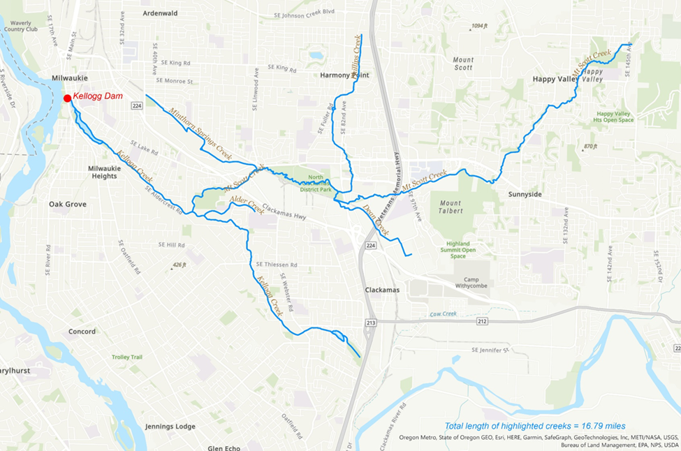
The Willamette Basin is Oregon’s largest river basin. It covers 11,487 square miles (12% of Oregon’s area) and contains 187 miles of mainstem from the confluence of the Middle and Coast Forks of the Willamette River to the confluence with the Columbia River in Portland, OR. The entire Willamette is critical habitat for anadromous fish. The Willamette Basin is also home to nearly 70% of Oregon’s population, over 50% of whom live within a 20-minute drive of the river. The Kellogg-Mt. Scott Watershed sits within this critical resource, approximately 15 minutes south of Portland. Kellogg Dam is located at the mouth of this ecologically critical urban watershed. The dam bars access to vital rearing and migratory habitat for all salmon, steelhead, and Pacific Lamprey as well as steelhead and coho salmon that have been observed attempting to spawn in the upper Mt. Scott Creek watershed during the few days a year where Kellogg Dam is passable.
Kellogg Dam was originally built in 1858 for a flour mill that ceased functioning in the 1890s. In 1934, the 99E highway bridge was built on top of the dam structure. It is a near-total barrier to both local spawning (coho and steelhead) and to floodplain access for rearing and resting habitat for the Clackamas and Upper Willamette fish populations, including threatened and endangered salmonids. The 14-acre impoundment behind Kellogg Creek Dam is the largest restorable off-channel area remaining in the lower Willamette between Willamette Falls and Multnomah Channel.
The North Clackamas Watershed Council (NCWC) led a collaborative planning process from 2019 to 2021 to identify partners and stakeholders for the project. That work charted a course forward that identified needs and constraints, desired outcomes, and multiple benefits. This process was convened by NCWC, the City of Milwaukie, and the Natural Resources Office of Oregon Governor Kate Brown. Participants included the Oregon Departments of Fish and Wildlife, Transportation, Environmental Quality, Division of State Lands, and State Historic Preservation Office, the US Fish and Wildlife Service, NOAA Fisheries, Clackamas Water Environment Services, North Clackamas Parks and Recreation Department, Metro, the Confederated Tribes of the Warm Springs Indian Reservation of Oregon, the Confederated Tribes of Grand Ronde, and members of the Oregon Congressional Delegation. This collaboration leveraged approximately $1 million in seed funding from private, local, state, and federal sources for project initiation.
See Project Partners and Funding for more information on leveraged funding.